Groundwater in the Morrison Formation of the San Juan Basin (before and after fracking) reportedly is not fit to drink, in stark contrast to the water on the east side of the Continental Divide in the Rio Chama Watershed.
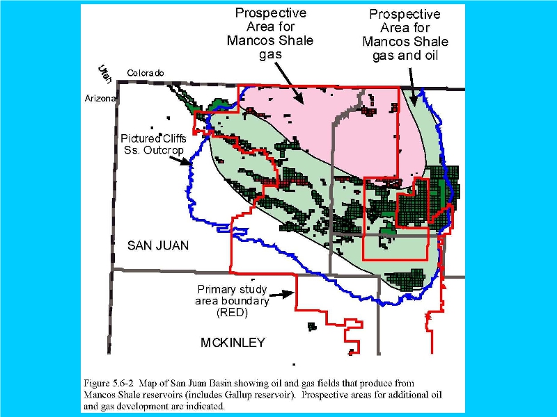
Unlike the EPA and others, BLM uses a solid bold line about seven times to indicate exposed Picture Cliff Sandstone east of the San Juan Basin (C. F. Brown?).
This contradicts the Geologic Map of New Mexico and others, depicting outcroppings near Dulce & Cuba.
Such targeting of formations for oil and gas leasing east of the Divide appears unstudied and poorly defined.