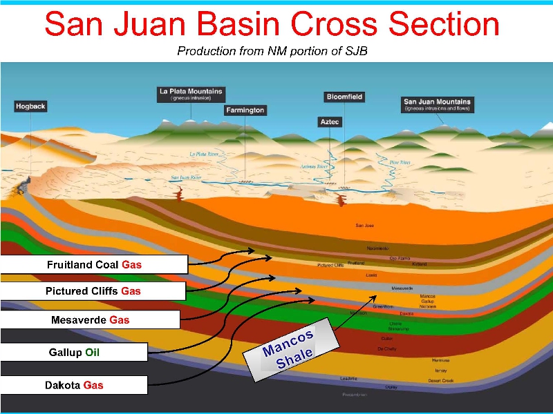
In the Rio Chama Watershed, glaciation and melt runoff ground and flushed away most of those formations still producing gas and oil in the San Juan Basin, to exposed Mancos Shale.
Tertiary and confining layers associated with the Kirtland, the Fruitland, the Picture Cliffs, the Lewis Shale and the Mesaverde group are mostly gone, exposing Mancos Shale.
Beneath the Mancos Shale lies Greenhorn Limestone and Dakota Sandstone that help to protect the water-bearing Morrison below, a locally-significant source of drinking water.
Glaciers ground surface Mancos Shale into Elpedro soil, which is highly corrosive to uncoated steel if used in well casings.
More than 50 early Rio Chama Watershed wells directly into surface Mancos Shale produced only water, not oil and gas.