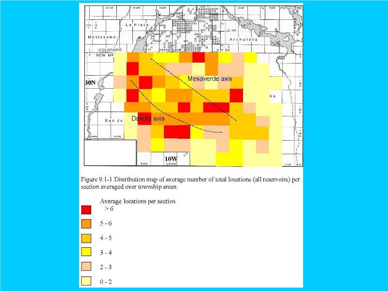

This map has no bearing upon parcels east of the Continental Divide (R01W and R01E).
The geology “depicted” by the dotted line in the east is undefined, since the map key appears redacted.
Since the Rio Arriba parcels in the Santa Fe National Forest appear outside BLM's Primary Study Area, there does not appear to be enough available information provided for any risk assessment or FONSI.
A full report on wells EAST of the Continental Divide might help dispel appearances of surreptitious BLM leasings.
Concealment and misinformation voids a NEPA scoping.