Again, parcels 1-5 and 14 &15, proposed for leasing in the Santa Fe National Forest, appear outside BLM's red-lined Primary Study Area, infra, and geology near and east of the Continental Divide appear largely ignored by BLM.
A dotted line “depicts” little in Pictured Cliffs outcropping.
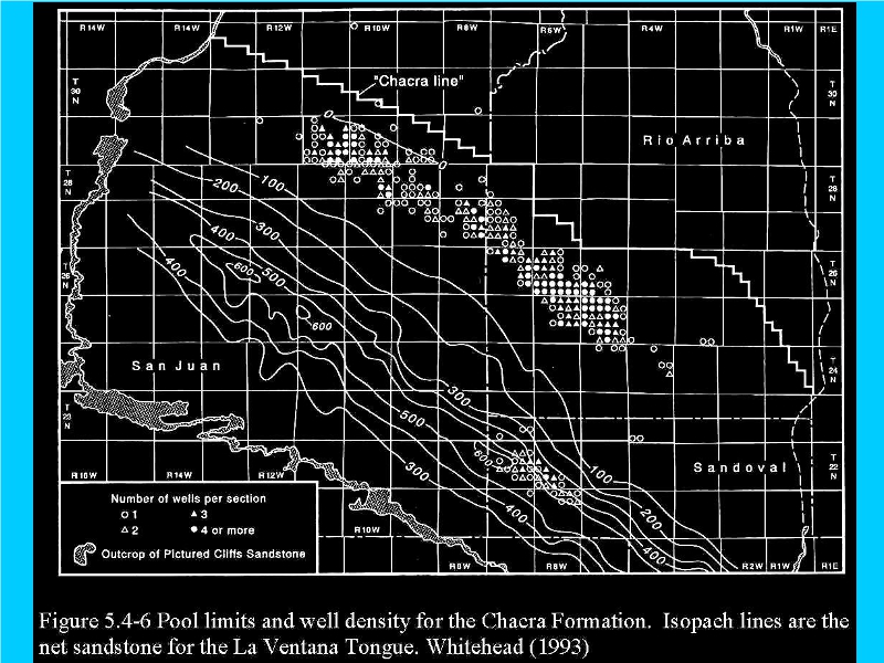
Presented well densities for the Chacra reservoirs are farther west, are under different surface geology, and therefore have little relevance to the leasing proposals.
Again, higher well densities dramatically increase risks to drinking water supplies in EPA-banned Class IV wells.
The Fruitland Formation is truncated and contact with the Pictured Cliffs Sandstone in the east is not well-defined.