A report prepared by the US Department of the Interior, US Geological Survey, NM Bureau of Mines and Mineral Resources, and the New Mexico State Engineer Office, illustrates multiple agency awareness of the Morrison Formation's outcroppings (“J” & Jm) in the Rio Chama Watershed (e.g., vicinity of Abiquiu Lake and elsewhere).
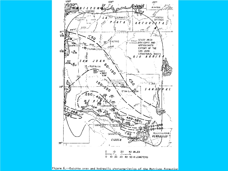
Note hydraulics of the Morrison Formation (Jm) all the way to Albuquerque, as far west as Shiprock, and as far north as Cortez, Durango, and Pagosa Springs, Colorado.
Outcroppings (“J”, map supra) are Illustrated to the right of the study area near Gallina and west of Abiquiu Lake.