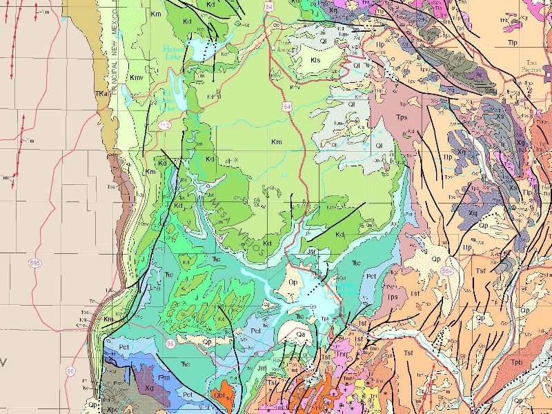
Water flow in the Rio Chama Watershed is contained in its glacially-carved “flume” by the Continental Divide to the west (by definition) and volcanic uplifts in the east.
The light green Mancos Shale (Km) is exposed to the surface of the Chama River Watershed within about a mile of Hwy 112, along which parcels 1-5 are located.
The Greenhorn Limestone and the Dakota Sandstone (Kd) are also exposed, but the latter helps to distinguish a seasonal water resource in the Mancos Shale from the deeper drinking-water-bearing Morrison Formation (Jm).
Faults (black) are near proposed leases and major Lakes.