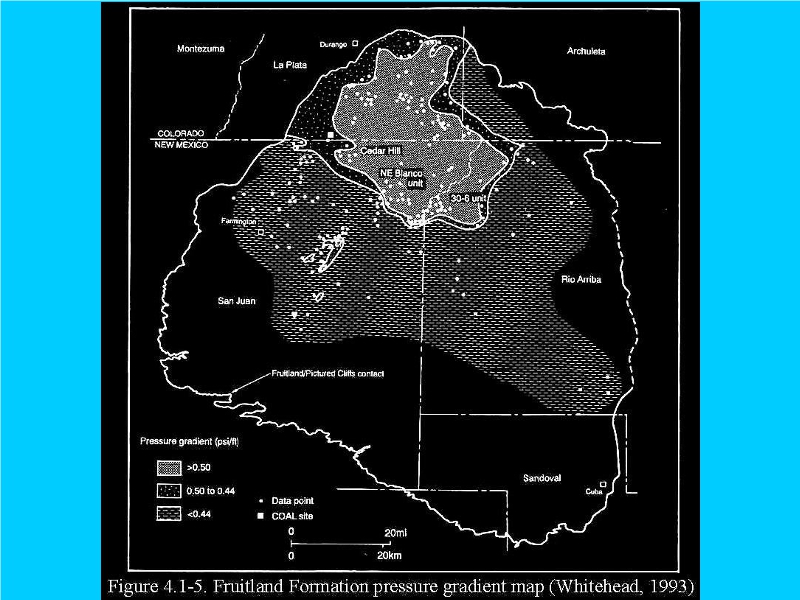
The EPA's study, supra, suggests that early glaciation along the Uplift affected contact between Fruitland Shale and the “Picture Cliffs” Sandstone as far south as present-day Cuba and almost as far north as Dulce.
A nebulous presence of this Picture Cliffs Sandstone contact or outcrop is “depicted” by a “dotted line” in eight figures referenced by the BLM in its “Reasonable Foreseeable Development Plan” as partial justification for its FONSI, Environmental Assessment determination.
Scientifically-presented “dotted lines”, especially when admittedly outside its red-outlined “Primary Study Area”, cannot be merely swept away, made bold, and ignored.