The EPA, BLM, and USGS have already evaluated water quality, flow, and formations in the San Juan Basin.
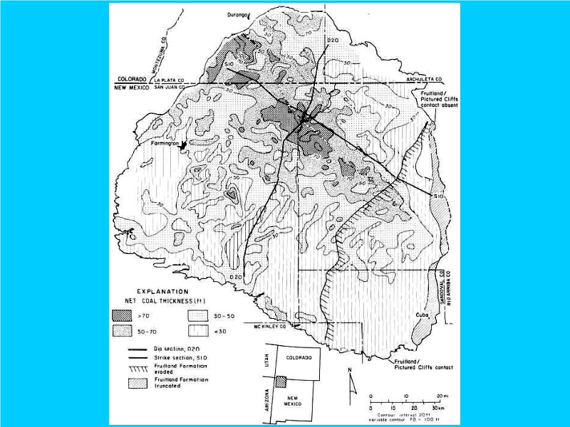
The EPA report shows that the eastern edge of the San Juan Basin lacks “contact” between the Pictured Cliffs Sandstone and the eroded and truncated Fruitland Shale.
Other maps confirm limited exposure of the Pictured Cliffs Sandstone only in the far north (Dulce) and south (Cuba).
A dotted line illustrates lack of exposure of the “Pictured Cliffs” elsewhere to the east of the San Juan Basin.
Merely changing a dotted line to bold on new maps does not justify a FONSI EA determination, and indicates a full EIS is needed for any oil and gas exploration to the east!