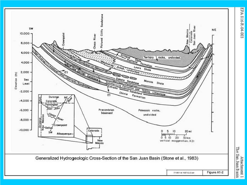
This diagram by William J. Stone, with numerous modifications in hydrological and geological reports, is referenced by the BLM, USGS, EPA, NMT, etc.
As definitively illustrated, infra, the strata above the Mancos Shale in most of the Rio Chama Watershed has been glacially removed and flushed with glacial melt.
The San Juan Basin has little outlet to the south, other than groundwater, thereby dampening glacial effects, therein.
The Rios Gallina and Chama Watersheds eventually drain southeast, enabling glacial stripping and melt erosion.
The Fruitland Shale is shown eroded and even truncated in the San Juan Basin near the Rio Gallina Watershed, infra.