In-depth keyed maps are available for the entire state in 4' X 4' hard copy or on-line, this key for map, supra, being excerpted on-line versions to e-mail-ability.
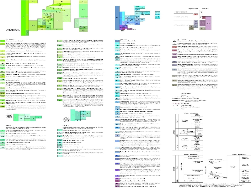
The BLM “reportedly” represented to the Rio Grande Sun that the Mancos Shale is thousands of feet below the surface with the water on top of that.
Unflooded, neither is true in the Rio Chama Watershed.
Morrison Formation (Jm) outcroppings along the Rio Chama Canyon are just UNDER the Dakota Sandstone (Kd), Greenhorn Limestone (Kgh), and the Mancos Shale (Km) that is often THE SURFACE Elpedro soil.
The Morrison is a drinking-water-bearing formation, here.