Seven figures presented by BLM have prospective representations of Pictured Cliff Sandstone eastern outcroppings, apparently based upon geology done in 1973, that conflict with those provided by the EPA showing erosion and truncation of the Fruitland Shale in the eastern San Juan Basin, and with other maps.
Ten Figures by BLM appear to represent the Santa Fe National Forest parcels 1-5 and 14-15 in Rio Arriba County as being outside BLM's Primary Study Area.
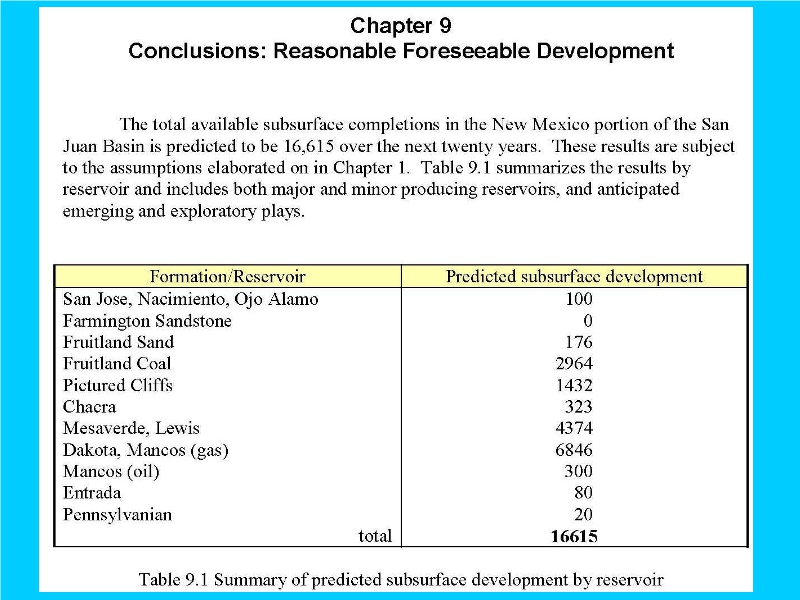
Fracking into the clearly targeted Mancos Shale and Dakota Sandstone, will unavoidably contaminate the Morrison Formation, thereunder, and its drinking water.