Eight of BLM's figures show easterly outcroppings of Pictured Cliff Sandstone, contradicting a reporting by the EPA and others of an easterly erosion and truncation of the Fruitland Shale and Pictured Cliffs Sandstone.
Oddly, 9 of BLM's figures indicate that proposed parcels 1 through 5, in the Santa Fe National Forest and Rio Arriba County, are outside BLM's own Principal Study Area.
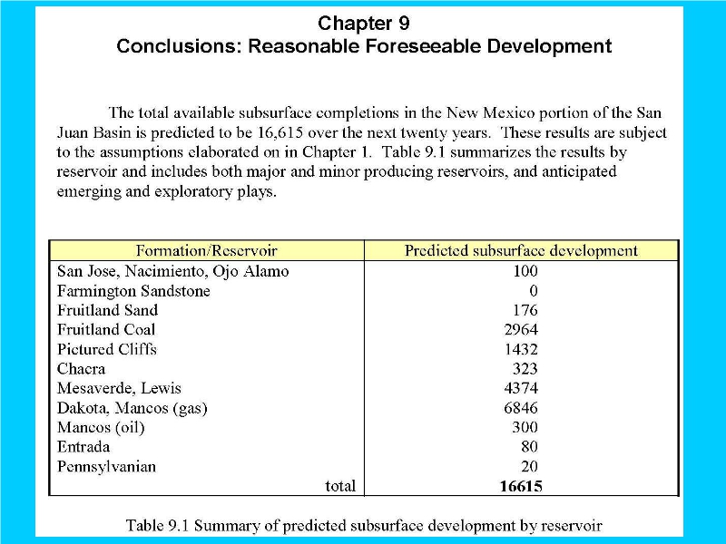
Fracking Mancos Shale and Dakota Sandstone, especially east of the Continental Divide, poisons our groundwater, further, including the Morrison Formation, thereunder.